 Cart(
Cart(
Small Format
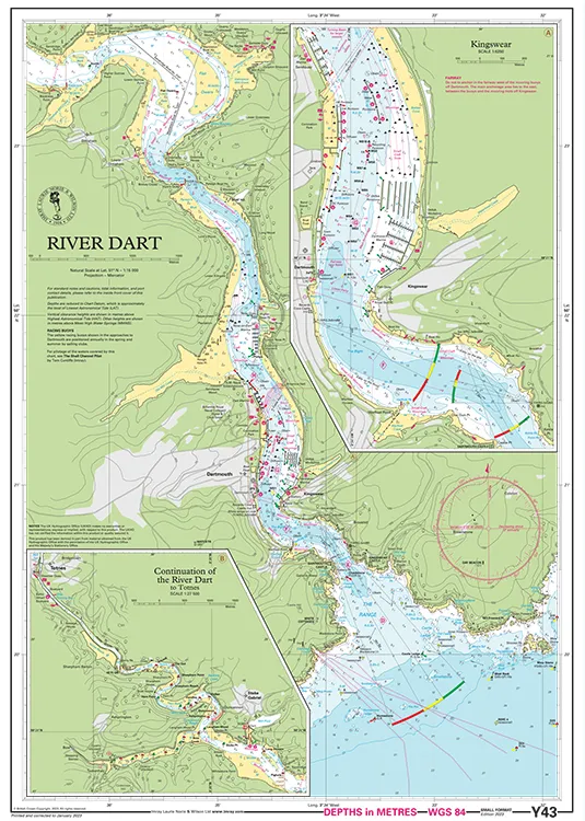
This chart is a replica of Imray chart 2300.13 covering the River Dart, its approach and entrance, and passage as far as Totnes. It is printed on water resistant paper.
This edition includes the latest official UKHO data, combined with additional information sourced from Imray's network to make it ideal for small craft. The chart has been fully revised throughout.
Plan included:
Kingswear (1:6250)


